
Type "350 Fifth Avenue, New York" and the app finds it instantly. Type a short city name on its own, "Springfield," or even just "New York" without a state, and there's a real chance the geocoder matches a different place entirely, one that happens to share the name. The address still resolves. It just resolves to somewhere hundreds of miles from every other stop on your route.
That's a specific, well-documented failure mode, not a hypothetical. Here's exactly how it happens, why it's nearly impossible to catch by scanning a list of addresses, and what actually catches it instead.
How One Address Ends Up Hundreds of Miles Away
Geocoding, turning a typed address into map coordinates, usually works quietly and correctly. The failure mode that matters here isn't a typo that fails to resolve at all — a completely unresolved address is easy to spot, since the app can't place it on a map and says so directly.
The harder case is an address that resolves to a real, valid location that's simply the wrong one. A short or ambiguous input, like a city name with no state attached, gives the geocoder room to match an obscure same-named town on the other side of the country, or the world, instead of the one you meant. The result looks completely normal in the stop list: a real street address, a real pin on the map. It's just eight hundred miles from where it belongs.
Why This Is Nearly Impossible to Catch by Eye
On a fifteen-stop route, one address text looking slightly off isn't something a driver reliably notices while typing addresses one after another. Nothing about the text itself is wrong; the input was reasonable. It's the resolved location that's the problem, and that's invisible unless you're checking every pin on a map individually before you optimize.
Left uncaught, a mis-geocoded stop doesn't just add a long detour. It can distort the entire optimized order, since the routing engine treats that phantom location as a real point to sequence around, or fail the optimize request outright with a raw, unhelpful error that gives no indication which of fifteen stops caused it.
What Actually Catches It Now
Fixing this meant checking something that hadn't been checked before: not whether an address resolved, but whether where it resolved makes sense next to everything else on the route. Every stop's position now gets compared against the rest of the route, and whichever one sits implausibly far from the others gets flagged directly, in red, on that specific stop, before the route ever gets optimized.
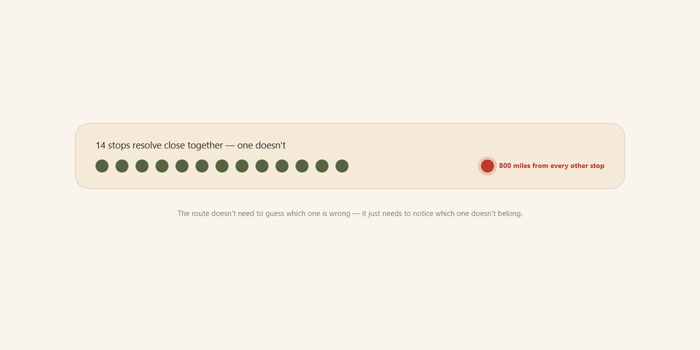
That distinction matters. A generic "something went wrong" error leaves you checking fifteen addresses one at a time. A stop that's individually flagged red is the one address you actually need to look at.
The Gap That Slipped Through Even After That Fix
The first version of this check only ran once a route had three or more points. That held up until a live error report showed the actual edge case: a route with no stops at all, just a start and an end address, where both had been mis-geocoded — most likely from a short city name matching the wrong same-named town. With no third point to compare against, the check never ran, and the route hit the map provider directly, surfacing a confusing raw error instead of a clear warning.
The same check now runs starting at exactly two points, and the red-highlight treatment was extended to the start and end fields themselves, not just regular stops. A two-point route with a bad address gets caught the same way a fifteen-stop one does.
What to Do When a Stop Gets Flagged
A flagged stop isn't a reason to delete it and move on. It's usually a specific, fixable problem with how much detail the address had: add the state, the zip code, or the full city name instead of a shortened version, then re-check it before optimizing. The flag exists specifically so this gets fixed before you're driving, not after you're already most of the way to the wrong side of the map.
The same check runs regardless of how the stop was added: typed, pasted, imported from a CSV, or read off a photo. However an address got into the route, it goes through the same sanity check before the route is trusted to optimize around it.
Final Thoughts
A mis-geocoded address is easy to miss and expensive to drive through: it looks like a normal stop right up until it isn't. Checking where an address resolved, not just whether it resolved, is what actually catches it, on a fifteen-stop route or a two-point one, before the detour, not after.
Fix My Route Team
We build route-optimization software for delivery drivers and couriers, and write about the planning and engineering problems that come up running real multi-stop days.
Keep reading
Why Your Delivery Route Falls Apart After the First Skipped Stop
Why a manually-planned route doesn't "self-heal," and what real-time re-optimization actually means.

Why Your Manifest Photo Import Comes Back With Missing Addresses
The three causes behind a light address read, and how to get a clean import every time.